Cloud Aerosol Polarization Imager (CAPI)
Description
| Satellite | TanSat |
|---|---|
| Weight | 80kg |
| Power | 70W |
| Number of Channels | 5 |
| Spatial Resolution | 250m / 1000m |
Characteristics
| Central wavelength | Bandwidth | SNR @ typical radiance | Polarization angles | Spatial resolution |
|---|---|---|---|---|
| 380nm | 43nm | 260 @ 28.0 W•m-2•sr-1•μm-1 | - | 250m |
| 670nm | 50nm | 160 @ 22.0 W•m-2•sr-1•μm-1 | 0°, 60°, 120° | 250m |
| 870nm | 30nm | 400 @ 25.0 W•m-2•sr-1•μm-1 | - | 250m |
| 1375nm | 30nm | 180 @ 6.0 W•m-2•sr-1•μm-1 | - | 1000m |
| 1640nm | 20nm | 110 @ 7.3 W•m-2•sr-1•μm-1 | 0°, 60°, 120° | 1000m |
Example Product
With integrated observation data, CAPI can generate global projection image daily with single channel and pseudo-color.
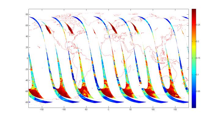
CAPI daily global image
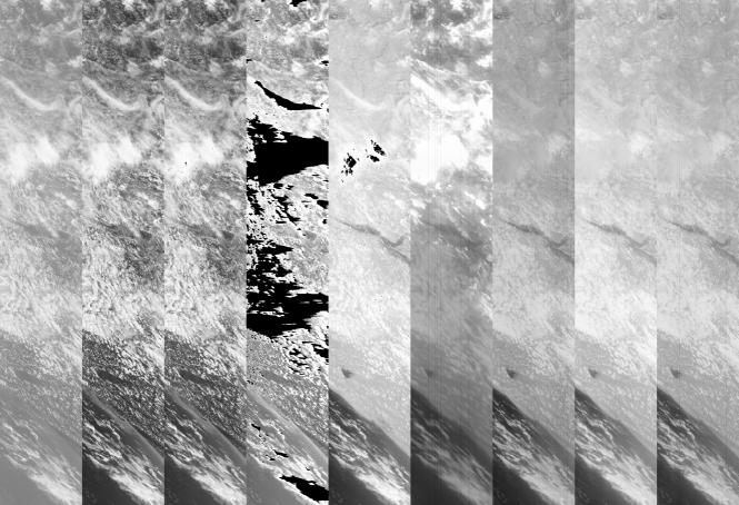
CAPI daily global projection image (part)
Three channel synthetic color image by CAPI (R=1640,G=870,B=670) show clear texture, distinguishable surface features and reasonable results of geographical location.
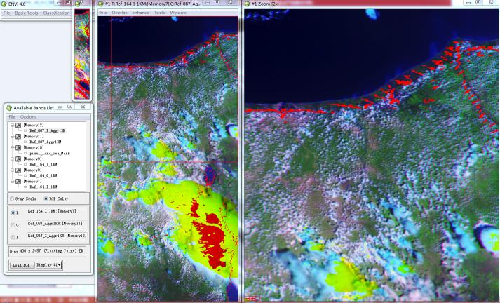
synthetic color image
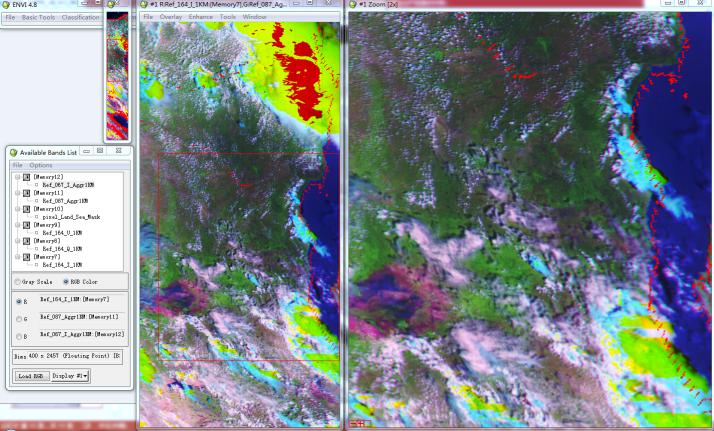
synthetic color image
Data and Products
| Satellite | Instrument | Datasets |
|---|---|---|
| TanSat | CAPI | Search |
Calibration and Validation
CAPI