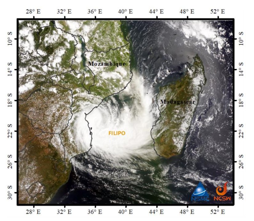
The FY-3D meteorological satellite true-color monitoring image shows (Figure 1): at 20:35 on March 11 (Beijing Time, the same below) , the main body of the severe tropical storm Filippo was located in the Mozambique Channel, and its peripheral cloud system has begun to affect the central and eastern areas of Mozambique.

Figure 1. FY-3D satellite true color image (March 11)
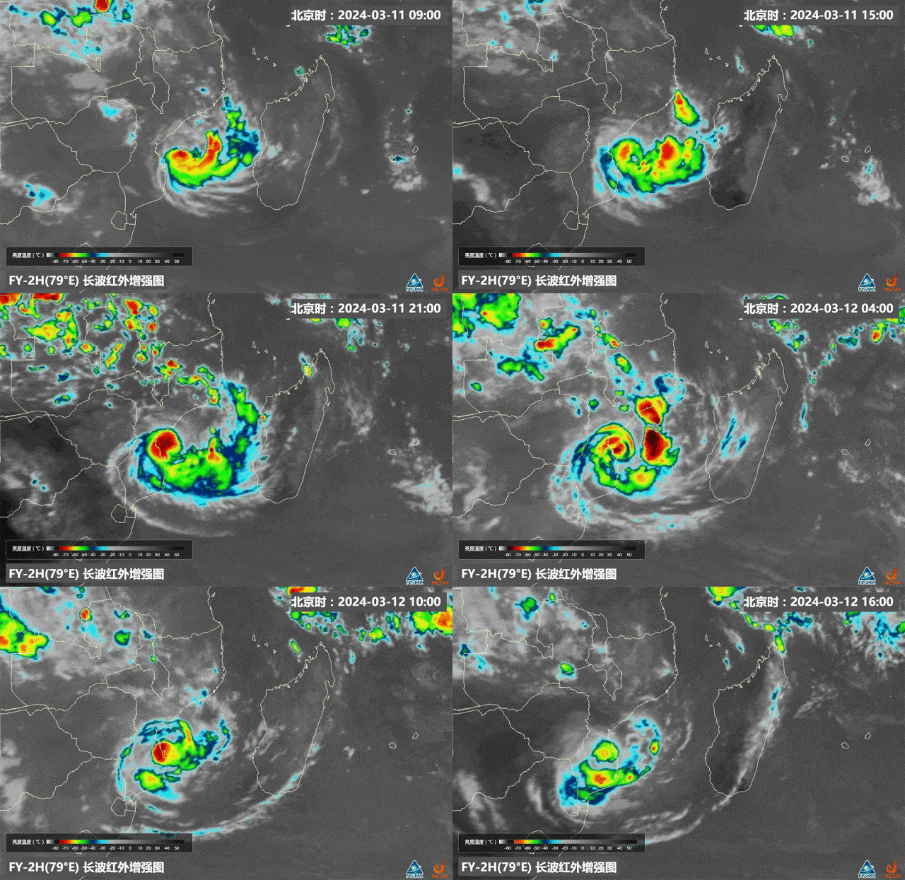
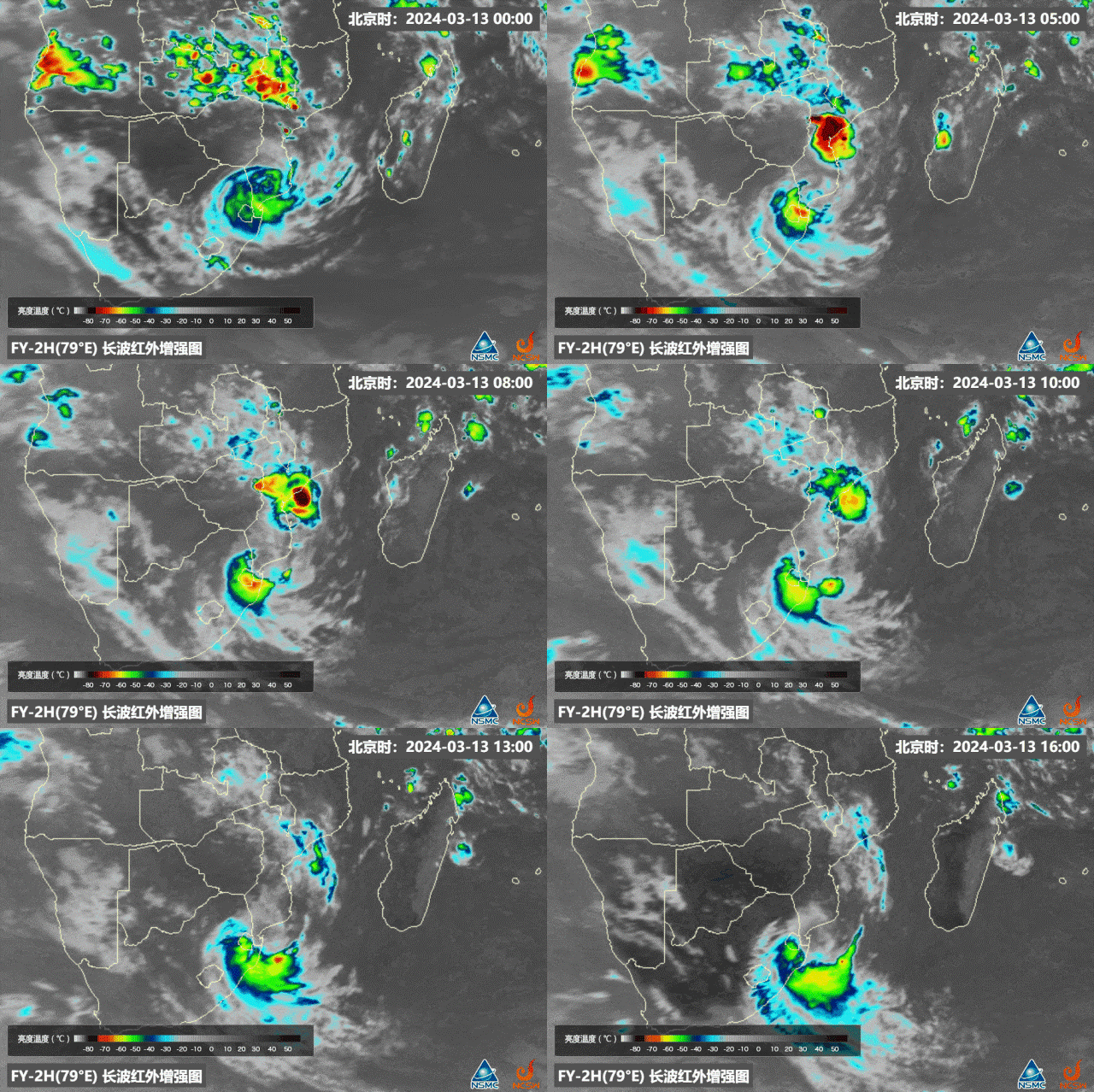
The FY-2H meteorological satellite infrared enhanced image shows that from 9:00 on March 11 to 16:00 on March 12(Figure 2), Filippo continued to pass through the central and southern parts of the Mozambique Channel, moving westward to the southeastern coast of Mozambique, with continuous enhanced intensity. Affected by Filippo, strong convective activities happened along the eastern coast of Mozambique, and the cloud top temperature in the center of the convective cloud system is lower than -70°C. From 0:00 to 16:00 on March 13(Figure 3), The convective cloud gradually moved towards southern Mozambique.

Figure 2. FY-2H IR Enhanced images(9:00, March 11-16:00, March 12)

Figure 3. FY-2H IR Enhance images(0:00, March 13-16:00, March 13)
Tropical Cyclone Filipo is predicted to fast movingsoutheastward towards the open water with a speed of 30-40 kilometers per hour. Its intensity is likely to be maintained or slight intensified. Heavy rainfall including localized torrential downpours are forecasted over southern Mozambique, Swaziland, and eastern South Africa.